
Walk Jefferson County Streets
A whole-street search works best as a chain. One source should supply the key for the next. Begin with a complete street number and name. The county assessment system converts that text into a parcel number, owner name, and legal description. The parcel map then shows where the lot sits among its neighbors. Recorded deeds explain the ownership chain. Permits add dated work at the site. Only after those land records are stable should voter material or historical directories be used to look for people.
- Search the exact address in CAPture. Copy the parcel number, situs address, current owner, and legal description.
- Open Tax Map and confirm the polygon. Check road labels, corner lots, split parcels, and the appraisal link.
- Search the owner in Landmark. Match deeds by lot, block, plat, or legal description rather than surname alone.
- Check the right permit office after confirming whether the parcel lies in Birmingham, another city, or unincorporated Jefferson County.
- Use lawful voter access and the library's street or householder directories only for the questions those sources can answer.
Repeat the process for only the parcels needed. House numbers do not always follow parcel order on curves, at intersections, or after subdivision. The resulting Jefferson County street directory is an evidence trail, not a single household list. It can show assessed owners, historic occupants, and named applicants, but those roles should never be merged without proof.
Jefferson County Address Records
Jefferson County address records differ in both reach and blind spots. CAPture and Tax Map describe the current tax parcel. Landmark records title instruments. Permit files are split by local jurisdiction. Old directories work by published edition, while voter access follows Alabama law and suppression rules. No one row below identifies everyone at a home.
| Record source | Address key | Street result | Main limit |
|---|---|---|---|
| CAPture assessment | Address, owner, parcel | Owner, situs, mailing address, value, legal parcel | Occupants are not listed |
| Tax Map | Parcel, address, map click | Lot shape, adjoining parcels, districts | Tax graphic, not a survey |
| Landmark Web | Name, document, date | Deeds, mortgages, liens, plats | Online cutoffs vary by division |
| Permit records | Site, parcel, case | Applicant, contractor, work, date | Keeper and legacy coverage vary |
| Directories | Street and house number | Named historic occupant or business | Editions and address sections vary |
| Voter information | Identity or purchased geography | Authorized registration fields | Nonvoters and protected voters are absent |
The correct starting point depends on the question. Use the parcel systems for present land identity. Use the deed index for a recorded owner trail. Ask the permit custodian about work at an exact site. For a former household, the dedicated Jefferson County city directory collections explain which editions survive and how their address sections should be read.
Note: A missing name may reflect a source's purpose or date, not proof that the person never used the address.
Jefferson County CAPture Fields
The Jefferson County Citizen Access CAPture portal is the practical first stop when the street address is known. Its modes search by owner name, property address, or parcel number. Start with the street number and core name. If punctuation, direction, or suffix blocks a match, reduce the text and retry. Once a parcel appears, the exact county identifier becomes the strongest key for the map and related assessment records.
| CAPture mode | Control | Required | Useful approach |
|---|---|---|---|
| Owner Name | Text | One search mode | Try surname or business, then punctuation and co-owner variants |
| Property Address | Text | One search mode | Begin with number and street name before adding direction or suffix |
| Parcel Number | Text | One search mode | Use the exact county parcel identifier |
| Search | Button | After criteria | Runs the selected mode |
| Clear/New Search | Button or link | No | Resets the prior query |
A parcel card may display the tax year, owner and mailing address, situs address, lot, block, plat, acreage, tax district, class, values, sales references, and a map link. Read the mailing field with care. It tells where the tax notice goes. It does not prove that the owner lives at the parcel. A homestead flag may support owner occupancy, but it cannot identify each person in the home.
Map Jefferson County Streets
The Jefferson County Tax Map turns a line in the street directory into mapped land. Search with the parcel number copied from CAPture, or locate the street and click the subject polygon. The identify window can expose parcel and district attributes. Aerial and base-map layers help distinguish a structure from the tax lots beneath it. Adjoining polygons are useful for studying a block, but they still name parcels rather than residents.
- Parcel
- A tract carried as one unit in the county's property system.
- Situs address
- The physical location assigned to the parcel, distinct from the owner's tax-mail address.
- Plat
- A recorded map that identifies subdivision lots, blocks, roads, and other land features.
- Criss-cross directory
- A directory arranged by street and house number rather than only by a person's surname.
The newer official Parcel Lookup draws from a layer rebuilt nightly with addressing, boundary, and ownership data. Its fields keep situs and owner correspondence data apart. They also include legal description, subdivision, plat references, acreage, neighborhood codes, municipalities, tax districts, and a maintenance date. The layer exposes no occupant, nonowner resident, phone, email, birth date, utility, or voter field.
Note: Parcel boundaries guide tax research, but only a survey can settle a disputed boundary on the ground.
Jefferson County Deed Links
A street address is not the safest deed key. Convert it first to the parcel and legal description. Then search the current assessed owner as a grantee in Landmark Web. Narrow the date around a sale reference if the parcel card offers one. A matching acquisition deed should repeat the land description and identify the prior grantor. That grantor can be searched as an earlier grantee to extend the chain.
The Landmark interface supports a general name search, specific document types, document categories, and begin and end dates. Results may show indexed name and role, document type, instrument number, recording time, book and page, cross-reference, page count, and image status. Birmingham index coverage begins in 1987 and images in 1993. Bessemer index and images begin in 1965. Older work moves to Probate deed books, grantor-grantee indexes, or archival microfilm.
The official Landmark interface shown below is the source for recorded-document work in the Jefferson County street directory.
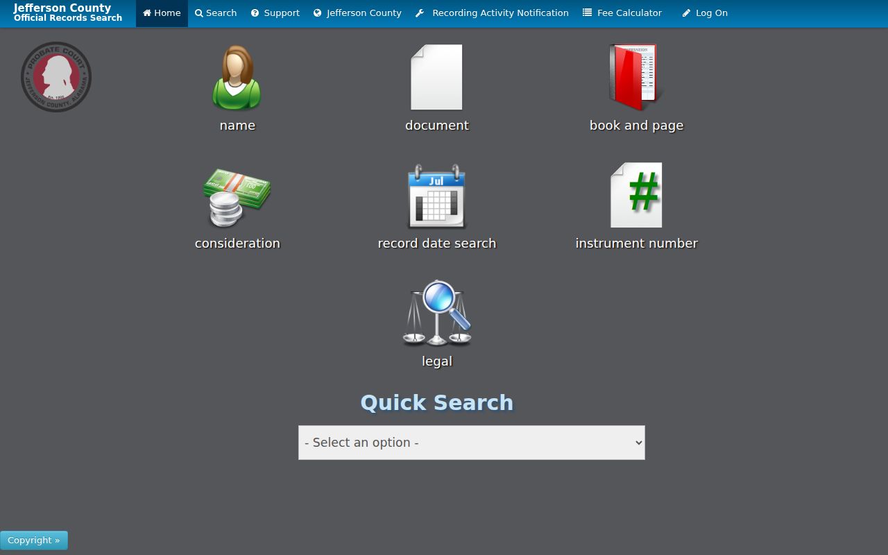
The screen supports a name-to-document search, but the deed itself must still be matched to the correct parcel and division.
Search tip. A decree affecting title may appear in Landmark, while the full court case stays with the Circuit Clerk.
Jefferson County Permit Trail
Permit research starts with jurisdiction. Birmingham parcels use the city system, other municipalities keep their own files, and unincorporated sites may use Jefferson County Development Services. The county ePermit Advanced Search can filter by record number, type, date span, project, license details, contact name or business, street-number range, street, city, state, ZIP, and parcel number. The modes group site address, contractor license, parcel, record, and contact information.
The county permit screen is captured below from its official source.
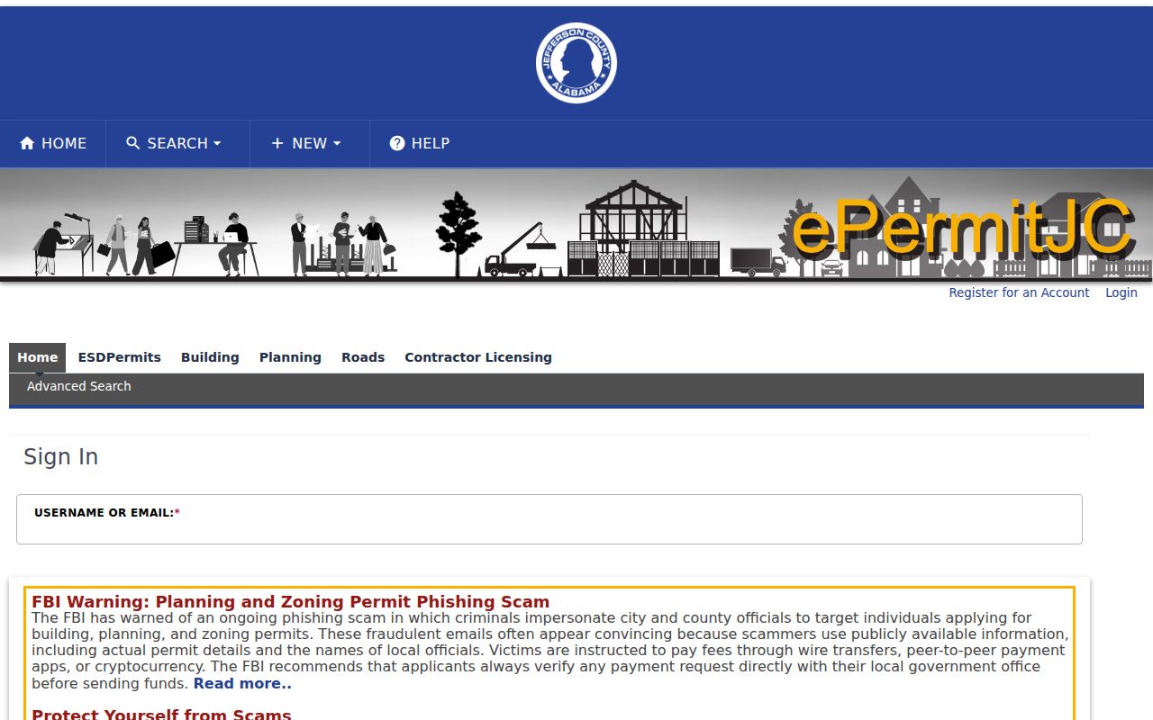
Its address and parcel filters can date work at a site, but the research did not verify the first year of online permit coverage.
Development Services can be reached at 205-325-5321 in courthouse room B-200. If a portal lacks the needed legacy record, send a focused request naming the exact street, parcel when known, record type, and date span. A permit may identify an applicant, licensed professional, contractor, project, or work date. None of those roles alone proves who occupied the property.
Jefferson County Address Changes
Jefferson County took over postal-address work from the Post Office in 1978. Ordinance 757 set county numbering and street-name rules in 1982, and rural route and box conversion was complete by 1994. The grid allows 500 addresses per mile, separates odd and even sides, and normally leaves gaps between assigned numbers. Those rules explain the current map. They do not make old text search clean.
County Addressing covers unincorporated land and most municipalities, while Birmingham, Fairfield, Graysville, Helena, Midfield, Mountain Brook, and Pleasant Grove have their own listed authorities. An address change triggers map and parcel research plus notices to the owner, site occupant, USPS, utilities, tax offices, registrars, law enforcement, city staff, and emergency services. USPS may keep delivering to an old address for up to one year.
For an unresolved mismatch, the county Address Discrepancy form asks for the address, city and ZIP, parcel ID, explanation, owner and occupant contacts, and department follow-up. The official authority matrix identifies the correct office. Historic research should preserve the old form of an address and bridge it with the plat, legal description, and library street-name aids.
Note: Keep both old and current address forms in the search log so later records can be traced without rewriting the evidence.
Read Jefferson County Streets Backward
A reverse or householder section can add people to the land trail. Birmingham Public Library's Southern History Department holds Birmingham directories from 1883 to the present, with no volumes published in 1933, 1936, 1943, or 1945. Whether a selected edition has a street section must be checked in that volume. The research did not verify the exact run of locally held criss-cross editions, so a catalog check or staff inquiry should come before claiming coverage.
When an address section exists, find the street, move to the house number, and transcribe the entry exactly. Then compare adjacent editions. Keep spouse, occupation, business address, residence notation, widow marks, and any householder code tied to that edition's abbreviation key. Directory absence can mean a skipped publication, spelling change, annexation, renumbering, or a household that was never listed.
Deeds show owners. Directories may show nonowner occupants. Census schedules, obituary indexes, and permits can fill the years between. This makes the by-address directory most useful when it is paired with land identity, rather than treated as a stand-alone current roll.
Jefferson County Counter Advantage
The web stops at different dates on each side of the county. Probate maintains Birmingham and Bessemer counters, and older deeds require record-room indexes or books. The Probate recording guidance says a mail copy request works best with buyer and seller names, a sale date, and the party or property address. Birmingham Probate is at 716 Richard Arrington Jr. Boulevard North. The Bessemer counter is at 1801 Third Avenue North. Both list weekday hours from 8 a.m. to 4 p.m.
Record-room staff provides free on-site training, but staff does not conduct a title search or prepare a deed. Unregistered Landmark access supplies public index information and a first watermarked page. Registered infrequent users pay $2 per page, while the stated subscriber plan is $125 per month plus $1 per page. At the counter, ordinary record-room copies are $1 per page, plats are $15 per page, and certification adds $2 per document.
This is a Profile 2 insider point: the counter can beat the web without replacing careful research. Bring names, dates, address forms, parcel data, and the division. Ask for copies of identified records. Do not ask staff to decide liens, title, residence, or family relationships.
Note: A division cutoff marks online reach, not the first year a Jefferson County deed can survive in another format.
Jefferson County Street Directory Limits
The Jefferson County street directory cannot prove a complete household. Assessment records leave out nonowner residents and most household members. Tax-map polygons contain no people fields. A deed identifies transaction parties, not everyone at the site. Permit applicants and contractors may work elsewhere. VoterView is an identity-gated personal confirmation tool, not an open whole-street browser. A separately ordered voter list may provide selected lawful fields, but nonvoters and protected records still remain outside it.
Motor-vehicle addresses are restricted, and utility or delivery accounts are not public reverse directories. Protected voters and sealed records should remain hidden. An empty result is therefore an index limit. For a question focused on one known person rather than everyone by street, use the Jefferson County resident lookup workflow and require two independent official sources before treating similar names as one person.
Lawful use. Use Jefferson County address records for family history, property research, scam checks, civic work, and personal safety. Never use them to stalk, threaten, harass, or expose a protected person.
A strong street search preserves uncertainty. Record the source date, role, and division beside each name. Separate owner from occupant, applicant from resident, and tax-mail address from situs. That discipline makes the street directory useful without claiming more than Jefferson County's records can show.