
Jefferson County ZIP Areas
The official Jefferson County parcel layer provides the most useful countywide ZIP inventory because it pairs mapped taxable parcels with a ZIP and parcel-city label. Its distinct values show codes attached to land from Adamsville and Adger through Birmingham, Bessemer, Hoover, Trussville, Warrior, Brookwood, and Vance. This is a parcel inventory, not a list of every postal product. PO-box-only and unique codes may not appear because they have no taxable situs, or physical property location, to map.
The Jefferson County ZIP code directory is best read in geographic groups. The table keeps the full parcel-bearing inventory visible without implying that the postal city is the legal municipality. “Fringe” means the delivery area reaches toward or across a neighboring county. “Physical parcels” means the official nightly layer contained mapped Jefferson County land with that code.
| ZIP | Areas Covered | Post Office Label | Local Note |
|---|---|---|---|
| 35005, 35006, 35036 | Adamsville, Adger, Brookside | Local place names | Physical parcels |
| 35020, 35022, 35023 | Bessemer and Hueytown area | Bessemer or Hueytown | Core southwest county |
| 35060, 35061, 35064 | Docena, Dolomite, Fairfield | Local place names | Physical parcels |
| 35062, 35063, 35073 | Dora, Empire, Graysville | Local place names | Dora and Empire reach toward Walker County |
| 35068, 35071, 35079, 35091 | Fultondale, Gardendale, Hayden, Kimberly | Local place names | Hayden fringes toward Blount County |
| 35094, 35146, 35173 | Leeds, Springville, Trussville | Local place names | Cross-county delivery geography |
| 35111, 35118, 35127 | McCalla, Mulga, Pleasant Grove | Local place names | Southwest and west county |
| 35116, 35117, 35126 | Morris, Mount Olive, Pinson | Local place names | Mount Olive office closed in 2017; place/ZIP retained |
| 35130, 35148, 35172, 35180 | Quinton, Sumiton, Trafford, Warrior | Local place names | Western or northern fringe; Trafford office closed in 2017 |
| 35203-35208 | Downtown, west, Southside, East Lake, North Birmingham | Birmingham | Core Birmingham sequence |
| 35209, 35210, 35213, 35216 | Homewood, Irondale, Mountain Brook, Vestavia area | Mixed preferred names | Postal and municipal labels differ |
| 35211, 35212, 35214, 35215 | Southwest, Woodlawn, Forestdale, Center Point | Birmingham or local city | Mixed city geography |
| 35217, 35218, 35221, 35222, 35224 | Tarrant, west Birmingham, Midfield, Avondale, west Birmingham | Mixed labels | Parcel city must be checked |
| 35223, 35226, 35228, 35229 | Mountain Brook, Hoover, Midfield, Samford/Homewood area | Mixed labels | 35229 is parcel-bearing institutional vicinity |
| 35233, 35234, 35235 | Central, north-central, east/northeast county | Birmingham or Center Point | Urban parcel areas |
| 35242, 35243, 35244 | Meadow Brook, Cahaba Heights, Hoover | Mixed labels | 35242 and 35244 cross into Shelby County |
| 35254, 35444, 35490 | West Birmingham, Brookwood, Vance | Local place names | Brookwood and Vance fringe toward Tuscaloosa County |
A code can cover more than one government jurisdiction. That makes the table a starting point for Jefferson County records, not proof that a city office controls an address. The parcel polygon and municipal fields settle the next step.
Jefferson County ZIP Parcel Layer
The official Jefferson County parcel service is rebuilt nightly from Development Services addressing, Tax Assessor boundaries, and Board of Equalization ownership. It stores a numeric ZIP beside the property address, parcel identifiers, owner correspondence fields, municipalities, school and fire districts, and record dates. The service also supports value lists, database filters, page-by-page results, and statistics, with web responses capped at 2,000 records.
The parcel service description shows why a ZIP code directory can narrow property geography while still falling short of a household list.
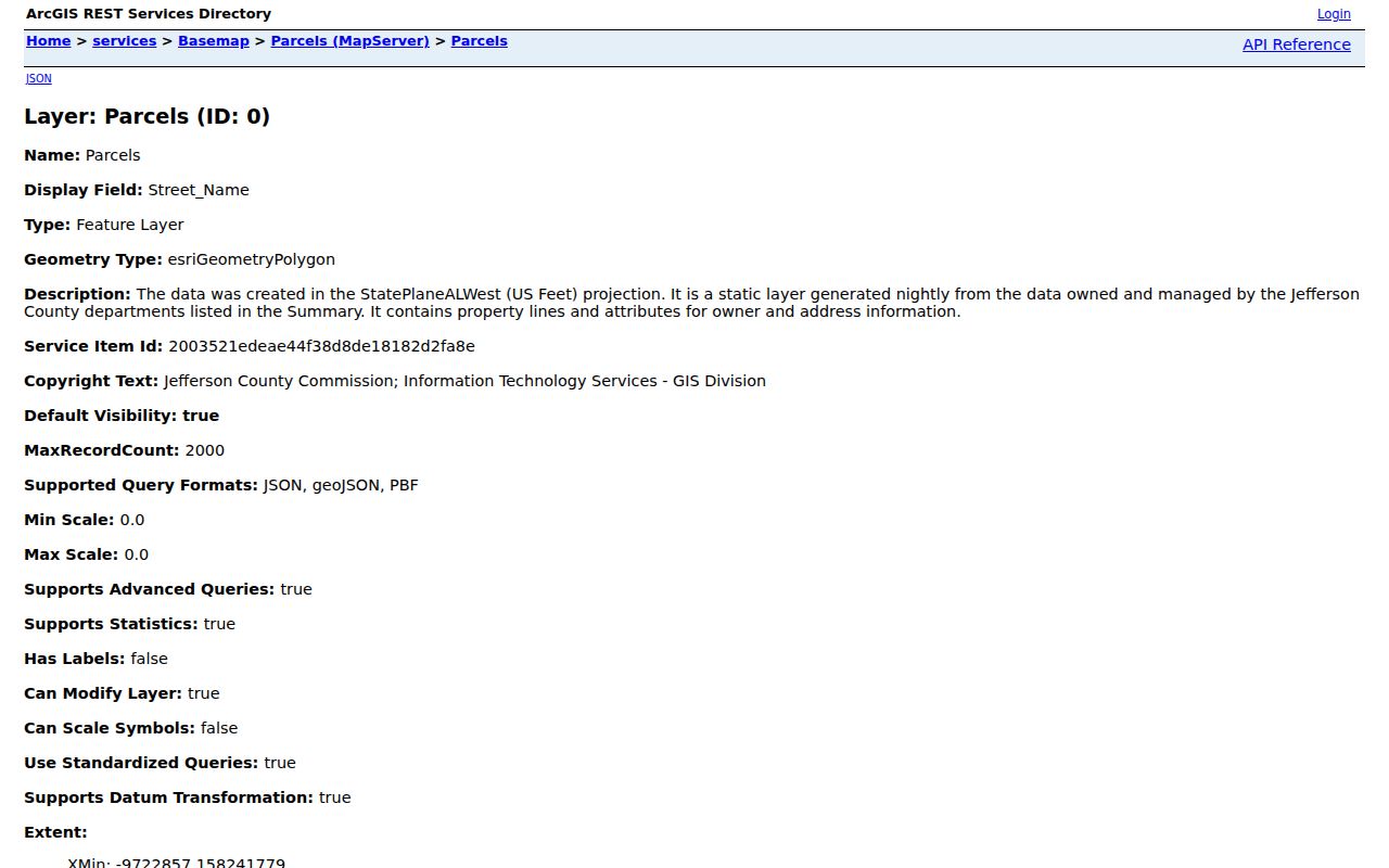
Each parcel record separates the situs address from owner mailing fields. That distinction matters. A matching ZIP identifies mapped land or correspondence, not every person who lives there.
The county also exposes the parcel-layer query endpoint used to inspect distinct ZIP and parcel-city combinations. Querying one code can return taxable parcels and assessment owners, subject to the response cap. It does not return renters, household members, phone numbers, utility customers, or a complete resident roll.
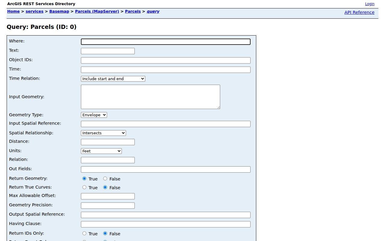
The query view documents the source and fields behind the inventory. For a visual search, use the county Parcel Lookup or Tax Map; for a property card, begin with CAPture by address, owner, or parcel number.
Note: Nightly refreshes improve currency, but parcel boundaries remain tax graphics and do not replace a survey or postal confirmation.
Search Jefferson County by ZIP
A Jefferson County ZIP code search works best as a narrowing sequence. USPS verifies the delivery label. County GIS identifies parcels and the government geography around them. Alabama voter data uses a separate request process. No single official portal combines these sources into a live household directory.
- Enter the full street address in the USPS lookup. Confirm the standardized ZIP and preferred city name before searching local records.
- Use the official parcel layer or Parcel Lookup to inspect land within that code. Copy the parcel ID and note the primary or secondary municipality.
- Open CAPture with the exact street address or parcel number. Compare the property situs with the owner mailing address rather than treating them as one field.
- If voter data is relevant to lawful civic research, use the quoted statewide voter-list request process. VoterView itself confirms one voter and cannot browse a ZIP.
- After the code narrows the area, switch to the Jefferson County street directory for an address-by-address record chain.
County Accela Advanced Search includes a ZIP field under Site Address for permit records. CAPture documents searches by owner name, property address, or parcel number, not a stand-alone ZIP mode. When a portal lacks a ZIP filter, search one verified address or parcel at a time rather than forcing a broad result into a resident claim.
Jefferson County ZIP Verification
The USPS ZIP Code Lookup is the authoritative first check for current delivery format. It can find a code from a complete address or show the preferred city names tied to a code. The interface does not establish county, municipal, tax, or voting boundaries.
| USPS Field | Input | How It Helps |
|---|---|---|
| Street Address | Number and street | Anchors the delivery point |
| Apt/Suite/Other | Secondary unit | Refines a multi-unit delivery |
| City | Place name | Checks the accepted postal label |
| State | Alabama | Separates same-name places |
| ZIP | Known or proposed code | Confirms or corrects the code |
The current address form is shown below from the official USPS lookup.
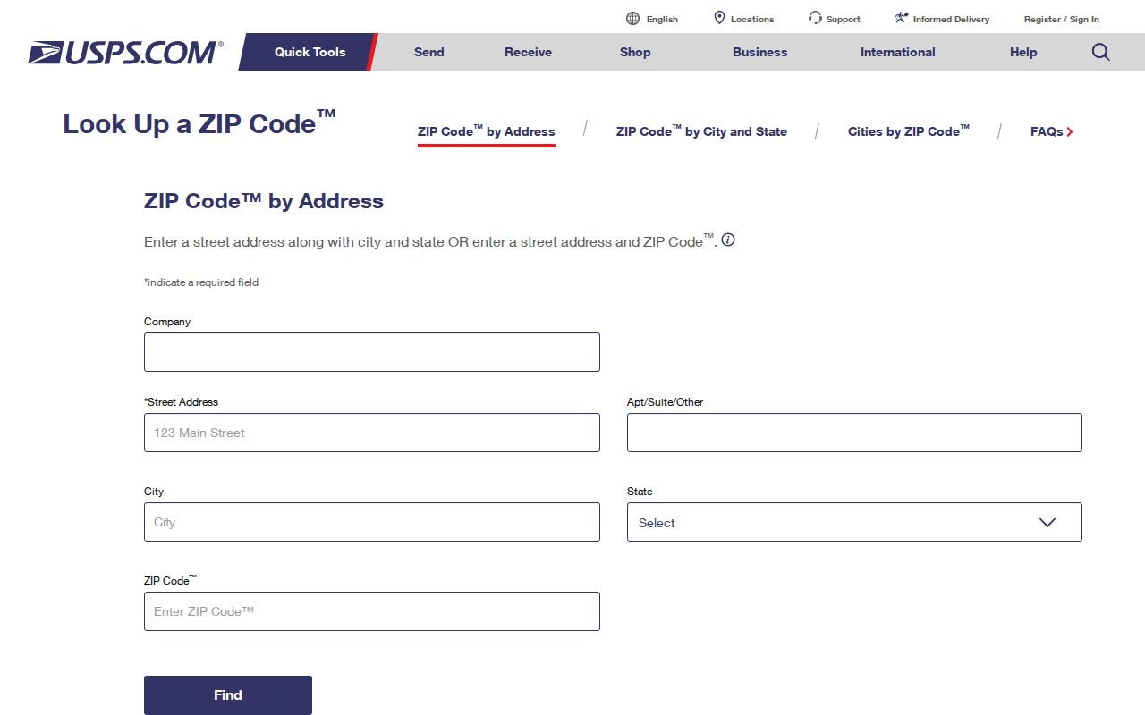
The USPS result should be carried into county GIS. A “Birmingham” delivery label may still point to unincorporated Jefferson County or another municipality, so postal verification is the start of the records search, not the final jurisdiction test.
Jefferson County ZIP Boundaries
Delivery geography and city limits often disagree in Jefferson County. Parcel-city labels in the 352 range include Homewood, Irondale, Center Point, Vestavia Hills, Tarrant, Midfield, Mountain Brook, and Birmingham. The outer inventory also reaches toward Blount, St. Clair, Shelby, Walker, and Tuscaloosa counties. Even the Bessemer Cutoff, which changes some probate, court, and election indexing, is not a ZIP boundary.
This mismatch changes where a records request goes. Confirm the parcel’s municipality before asking Birmingham for a permit or code file. County Addressing handles unincorporated areas and most municipalities, while Birmingham, Fairfield, Graysville, Helena, Midfield, Mountain Brook, and Pleasant Grove have their own addressing authorities.
- ZIP Code
- A USPS delivery code. It is not a municipal or county boundary.
- ZIP+4
- The base code plus four digits that refine a delivery segment, building, or group of addresses.
- PO-box ZIP
- A code used for post-office boxes rather than mapped property locations.
- Unique ZIP
- A code assigned to one high-volume institution or organization.
- Carrier route
- A postal delivery path within a ZIP, not a public resident district.
Note: A Birmingham postal label should be checked against the parcel municipality before any city permit or records request is filed.
Jefferson County Address Grid
Modern ZIP searching sits on a county address system that changed sharply in the late twentieth century. Postal-address responsibility moved from the Post Office to Jefferson County Public Works in 1978. Ordinance 757, adopted November 9, 1982, set numbering, street-name, and enforcement rules. By 1994, rural route and box references had been converted so all county addresses had street numbers.
The grid allows 500 addresses per mile, separates odd and even sides, and usually skips at least four numbers. That order helps emergency response and parcel work. Yet an old rural route may fail in a modern ZIP code directory even when the same land is easy to find by parcel number or legal description.
For historic research, keep both address forms. Use BPL old/new street-name aids, recorded plats, and the parcel legal description to bridge the conversion. Never rewrite an old directory entry as though the modern street number appeared in the original source.
Correcting Jefferson County ZIP Records
A mismatch can come from a postal label, tax-roll location, municipal boundary, or mapping issue. Jefferson County’s Address Discrepancy form asks for the address, city and ZIP, parcel ID, explanation, owner and occupant contact details, and the submitting department’s information. The county then researches maps and parcels. It updates its address map and tax-roll location field when a change is approved and sends notice to affected agencies and the site.
County Addressing can issue a certified verification letter for $15. New subdivision addresses receive final mailing approval after the plat is recorded; without a preliminary plat, the stated turnaround after recording is 48 hours. USPS may continue delivering to an old address for up to one year after a change, so two labels can briefly appear in otherwise current records.
Use the official addressing authority matrix before calling. It separates county service from the municipalities that keep their own authority.
Boundary check. A valid USPS code proves a delivery label, while the parcel map and addressing authority establish local record jurisdiction.
What Jefferson ZIP Records Prove
A ZIP result proves less than many searches imply. A parcel hit links a piece of land to a situs and assessment owner. An owner mailing ZIP shows where tax correspondence goes. A voter-list extract can show selected registration fields for a requested geography, but protected categories and nonvoters remain absent. A permit can connect an applicant, contractor, or owner to work at a site on a given date.
| Source | Strong Evidence | Not Established |
|---|---|---|
| USPS lookup | Current delivery format | Municipal limits or occupancy |
| Parcel layer | Mapped land, situs, assessment owner | Every household member |
| Owner mailing field | Tax correspondence destination | Owner’s present residence |
| Voter list | Released registration fields | All residents or ballot choice |
| Permit file | Dated project and named parties | Current household |
The sound method uses dates and source labels. It also accepts gaps. Jefferson County has roughly two-thirds of a million residents spread across 36 incorporated communities and unincorporated land, while the property roll measures parcels rather than people.
Jefferson County ZIP Privacy
Alabama Votes VoterView requires first name, last name, date of birth, and an election selection after a match. It is a personal confirmation tool, not a way to browse everyone in a code. A separate voter-list request may seek selected geographic and residence fields under Ala. Code §17-4-38, with a quote issued before fulfillment. Protected officials, spouses, and domestic-violence voters may have details suppressed.
Do not try to fill protected gaps with motor-vehicle, utility, or delivery data. Motor-vehicle personal information is generally closed by the federal Driver’s Privacy Protection Act. Old recorded images can also expose sensitive numbers that should never be republished. A ZIP code directory serves lawful family, civic, property, and personal research only when it preserves those limits.
Note: A missing person or parcel in one ZIP search may reflect boundary, spelling, index, protection, or source-date limits rather than absence.